

Precision Positioning Solutions Built for India
World class GNSS Technology Delivering Centimeter-Level Accuracy for Surveying, Mapping, GIS, Construction, Agriculture and Infrastructure Applications. Calibrated locally for seamless integration with regional satellite systems and standard surveying workflows.
Trusted Technology For Mission-Critical Projects
Mining
Agriculture
GIS Mapping
Government Projects
Infrastructure
Railways
Smart Cities
Construction


Engineered for absolute accuracy
Our hardware is calibrated specifically for the challenging environmental and satellite conditions of the Indian subcontinent, ensuring uninterrupted field operations.
Centimeter RTK Accuracy
Field-Tested Ruggedness
Zero-Downtime Support
Achieve reliable centimeter-level positioning with multi-constellation tracking optimized specifically for NavIC regional satellites under dense canopy.
IP67-rated protection ensures dustproof and waterproof performance in extreme Indian site temperatures ranging from Rajasthan to Kerala.
Minimize costly on-site delays with direct access to our localized calibration services and dedicated Indian technical support teams.


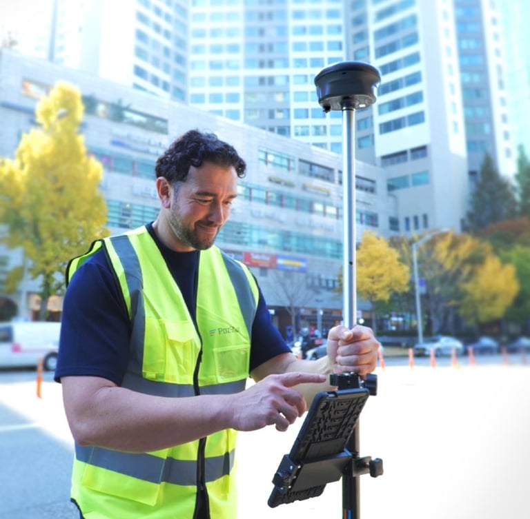
World-class geodetic receivers
Dhruva Base
High-accuracy stationary base station providing continuous correction data across vast surveying sectors with reliable, zero-downtime field performance.
Dhruva GNSS Rover
Our flagship high-precision GNSS receiver featuring full NavIC compatibility, tilt compensation, and a rugged magnesium alloy housing built for demanding infrastructure projects.
INDUSTRIES WE SERVE
Land Surveying
Boundary surveys
GIS Mapping
Geospatial projects
Construction
Site layout & positioning
Railways
Track and corridor mapping
Mining
Volume calculations
Agriculture
Precision farming
Utilities
Asset mapping
Smart Cities
Urban planning
Secure centimeter-level precision today
Equip your surveying teams with rugged, NavIC-compatible GNSS hardware calibrated specifically for India's toughest infrastructure terrains.